The dashboard edit page provides two panels for working with chart data: the visualization panel, where you add fields, configure styles, and set up advanced features; and the data processing panel, where you transform data and create new fields for analysis.
-
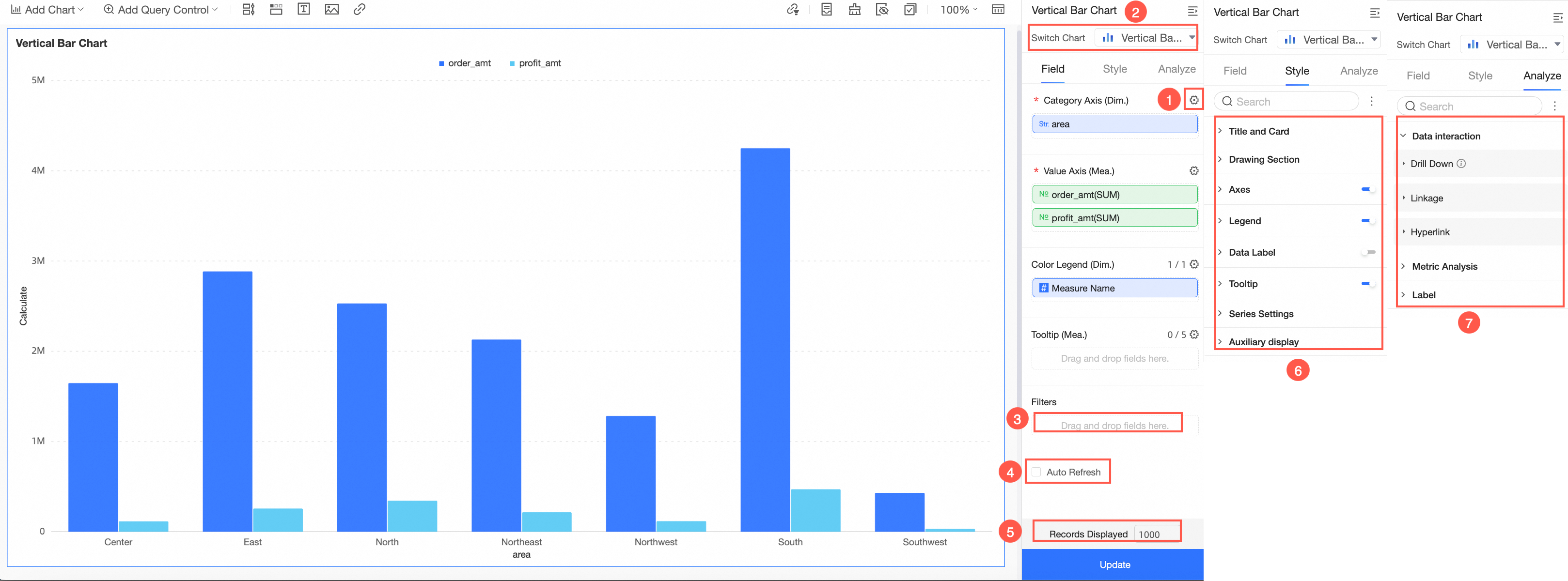
In the Visualization visualization panel, you configure what data a chart shows and how it looks.
-
In the data processing panel, you create and transform fields to support analysis beyond what the raw dataset provides.
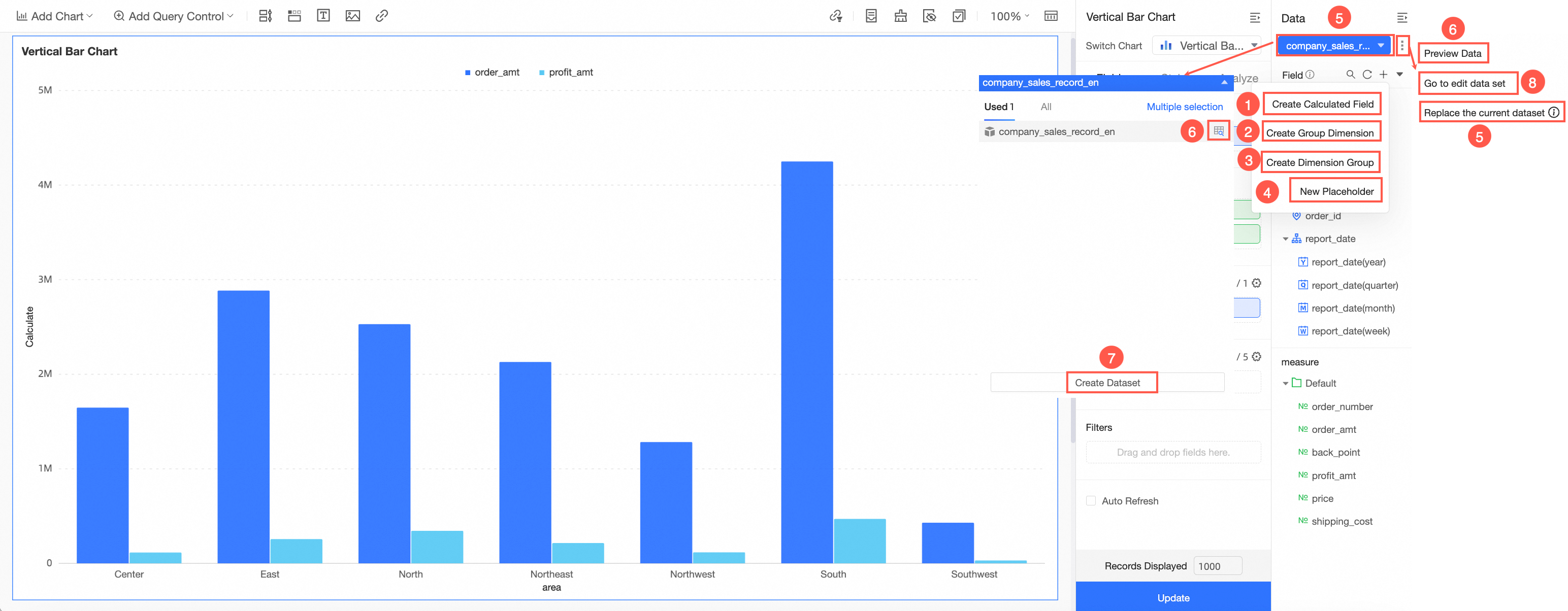
Available operations in the data processing panel:
Visualization
Use the Field, Style, and Advanced Settings tabs to control what data a chart shows and how it appears.
Field configuration
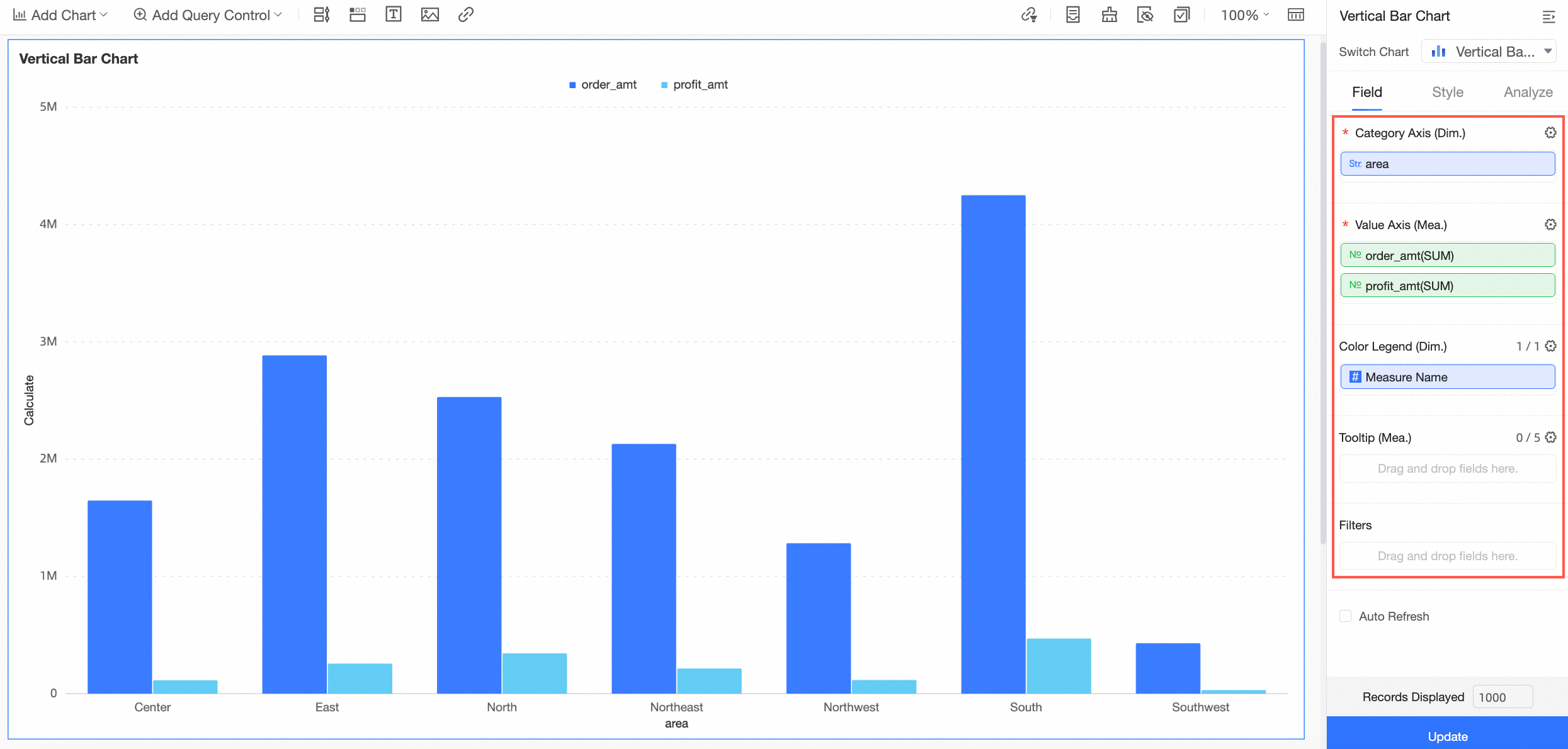
The fields you add to a chart determine the data it displays. The required fields vary by chart type. For more information about the data elements supported by each chart, see Use cases for charts.
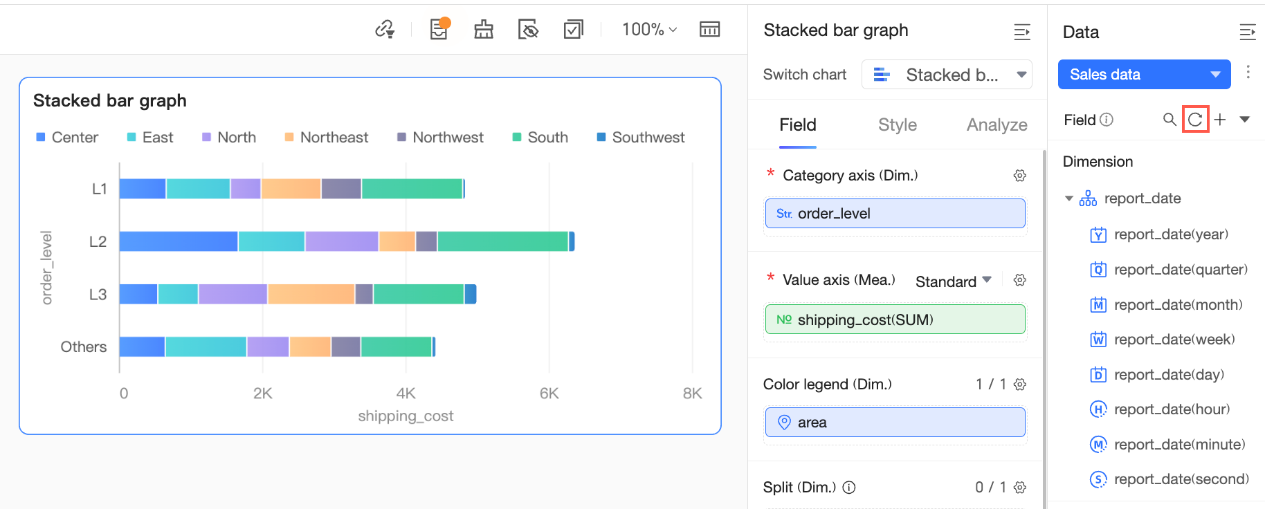
The fields shown in the data area may differ from those in the dataset preview. Click the refresh icon to load the latest field information.
Additional operations available in the Field panel:
-
Configure multiple fields at a time
When you need to modify multiple fields, you can configure them in bulk to improve efficiency.
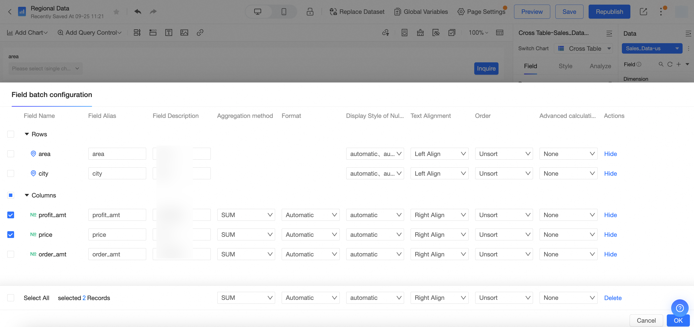
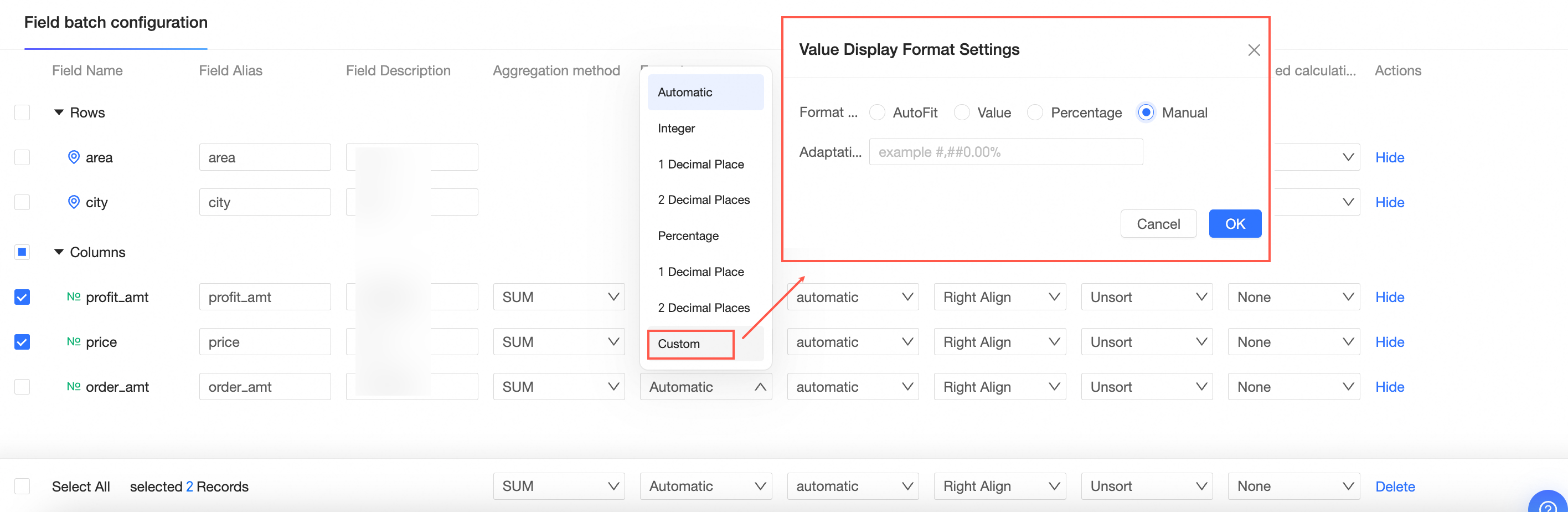
When bulk-setting the format for measure fields, selecting Custom lets you apply a numeric format for negative numbers, and the manual input option lets you specify formats such as ##0.00%. For details, see Configure Chart Fields.
-
Change the chart type
Switch the chart type to better suit the data or the insight you want to communicate.
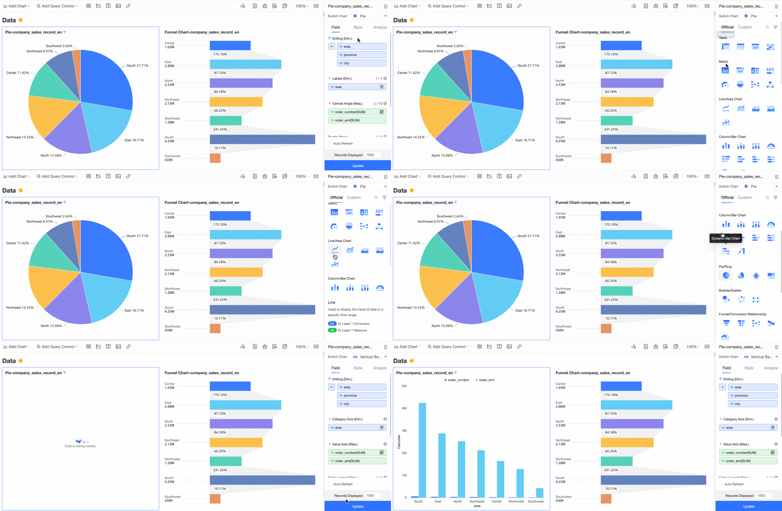 Note
NoteIf the chart type cannot be switched, the current data elements are incompatible with the target chart type. The system highlights the elements that need adjustment. Follow the prompts to add the required fields from the dimension and measure lists to the corresponding areas.
-
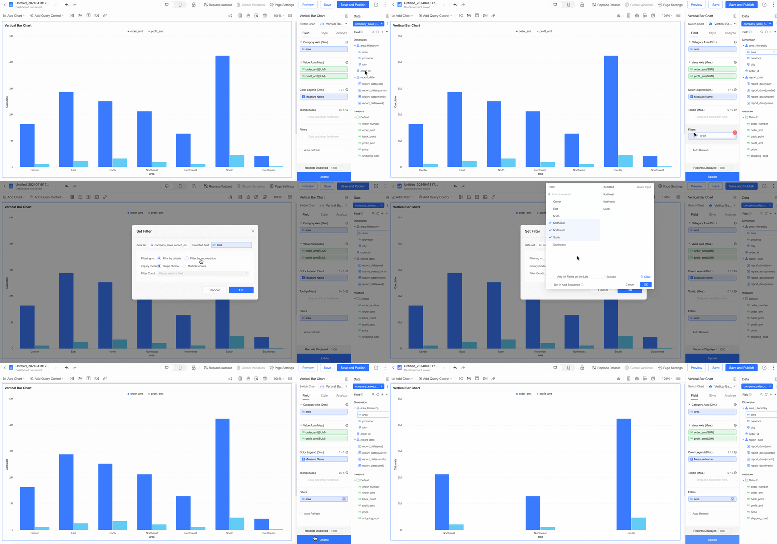
Configure a filter
A filter limits the data shown in a chart to a specific range or set of values. Use filters when working with large datasets to focus the chart on the most relevant data.
-
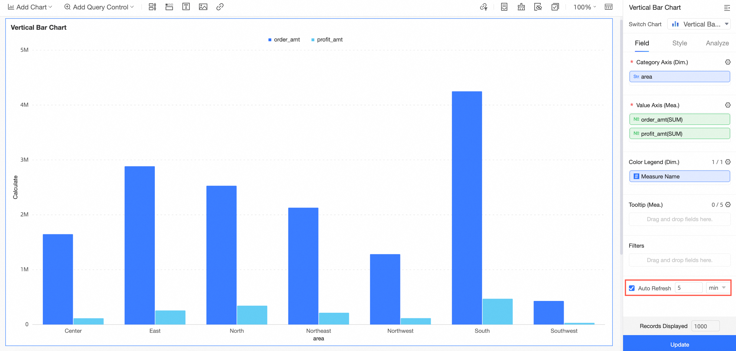
Automatically refresh chart data
Enable auto refresh to keep chart data current without manual intervention. For example, setting the interval to 5 minutes causes the chart to reload its data every 5 minutes.
-
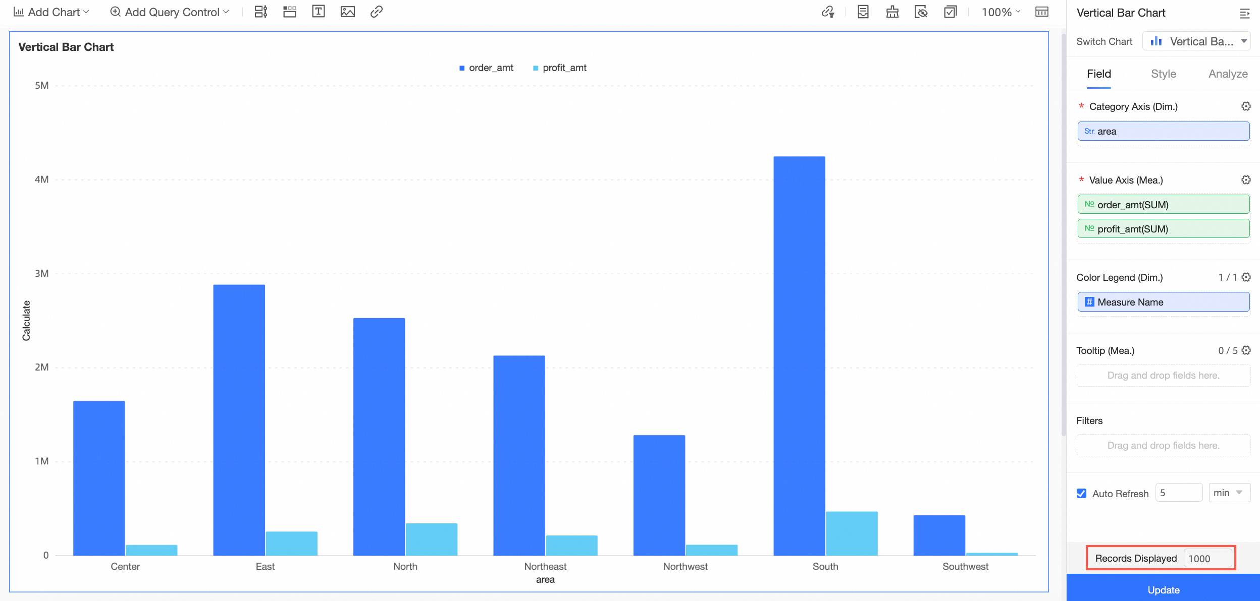
Set the number of rows to preview
Style configuration
The style determines the appearance and level of detail in a chart. You can configure the chart style here.
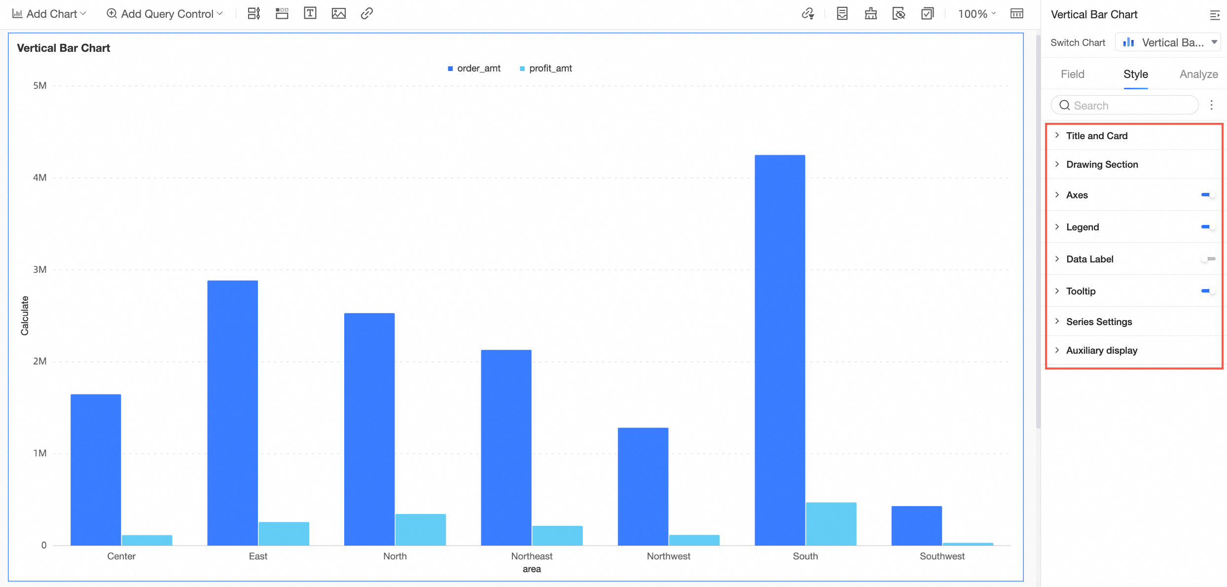
Available style options vary by chart type. For configuration examples, see Configure chart styles.
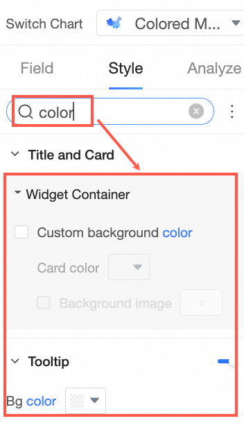
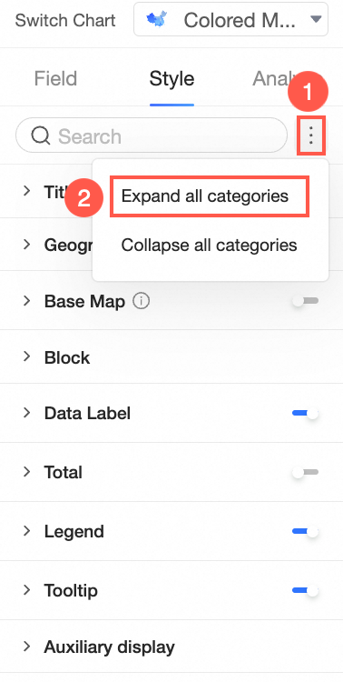
To find a specific setting quickly, type keywords in the search box at the top of the panel. Matching options appear immediately.
To view all settings at once, click the  icon to the right of the search box and select Expand all categories.
Advanced settings
The advanced settings determine whether data can be linked across multiple charts, which enables dynamic interaction and comparison.
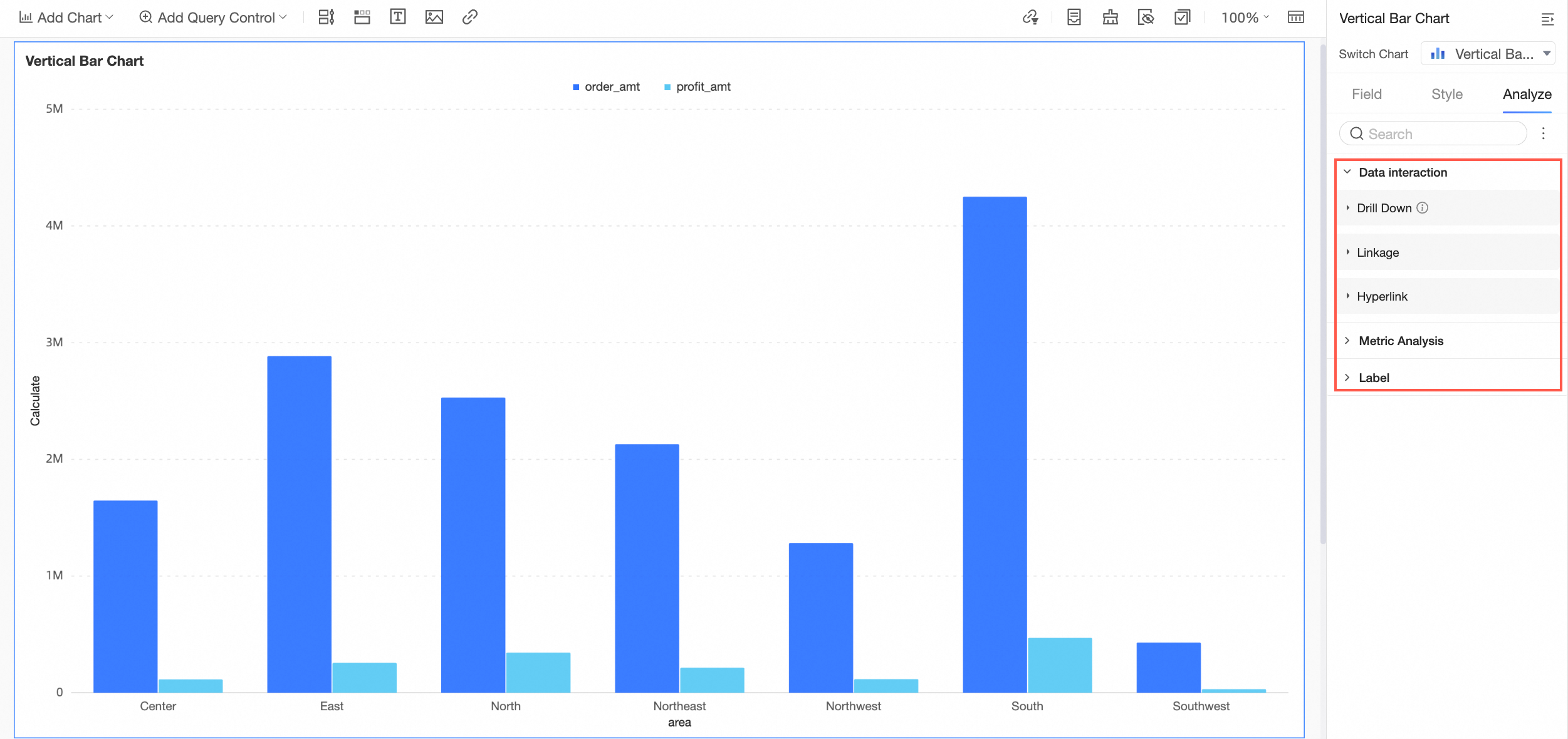
For details, see Drilling, filter interaction, and hyperlink, Metric analysis, and Label.
Data processing
Keep the following in mind when working with fields in the data processing panel:
-
A new calculated field is not saved back to the dataset — it applies only to the current chart.
If you create another chart and select the same dataset, the calculated field will not carry over.
If you duplicate a chart that contains a new calculated field, the duplicated chart retains that field as long as it uses the same dataset.
The data processing panel supports these operations: Create a calculated field, Create a group dimension, Create a dimension group, and Create a placeholder.
Create a calculated field
When the dataset doesn't contain the exact data needed for your analysis, create a calculated field to derive it from existing fields.
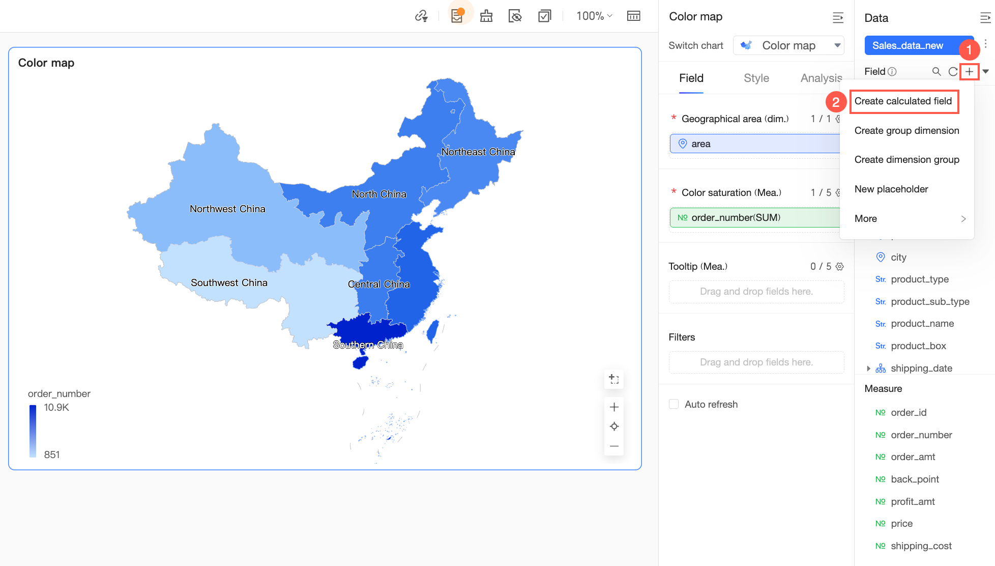
For detailed instructions, see Create a calculated field.
After creating a calculated field, you can perform additional operations on it:
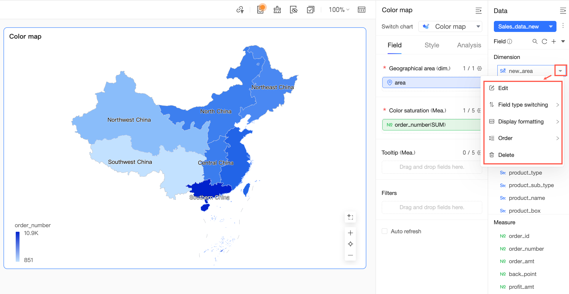 For details, see Configure chart fields.
-
When you change the field type to Geography and set the level to Continent, Country, Region, Province / Municipality, City, or District / County, you can configure geographic data matching.
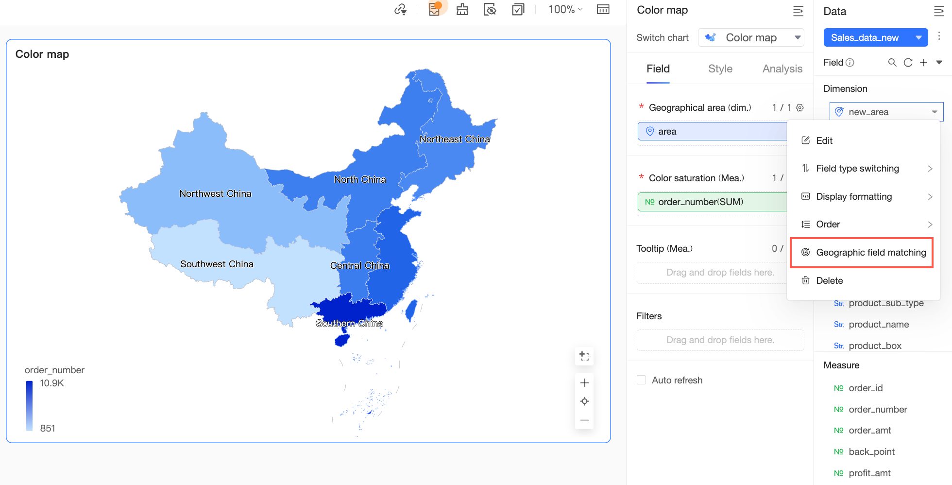 Note
NoteGeographic data matching aligns city and country names in your dataset with the standard geographic names the system uses for maps. In most cases, the system matches names automatically when rendering the map, so no manual action is needed. Configure matching manually only when field names differ from system standards or are not recognized, to ensure data appears in the correct locations.
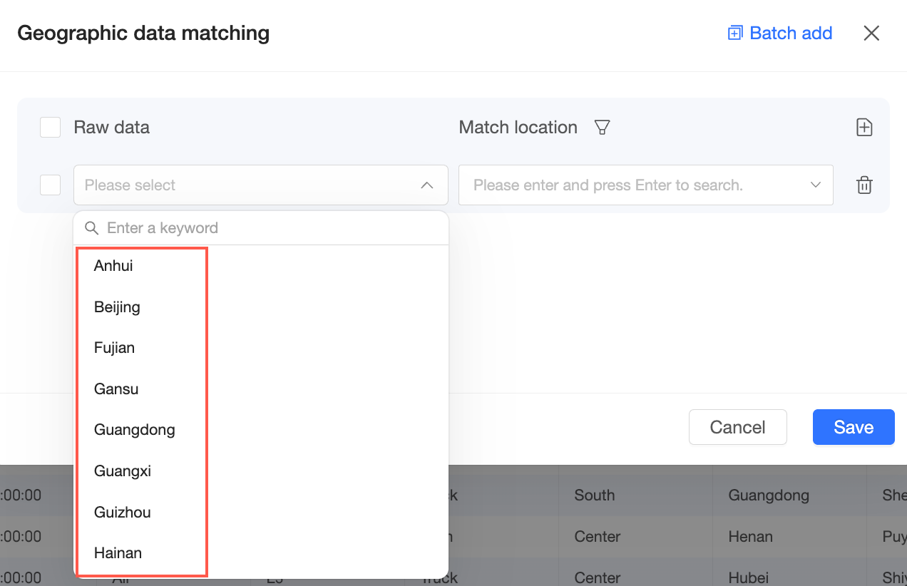
For detailed instructions, see Configure chart fields.
Create a group dimension
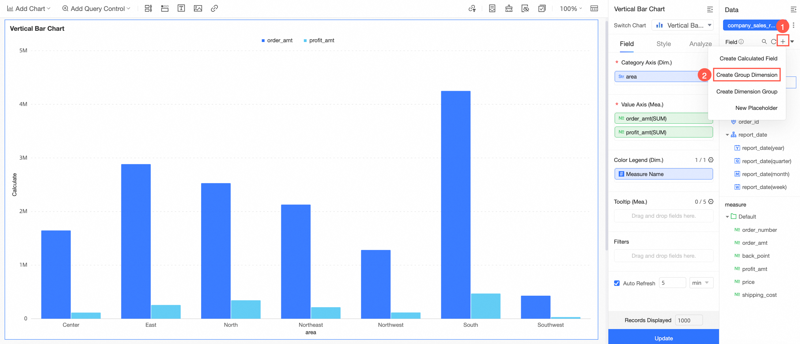
For detailed instructions, see Create a group dimension.
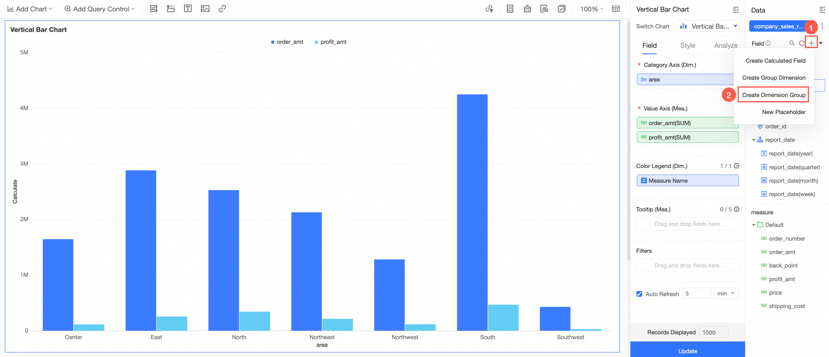
Create a dimension group
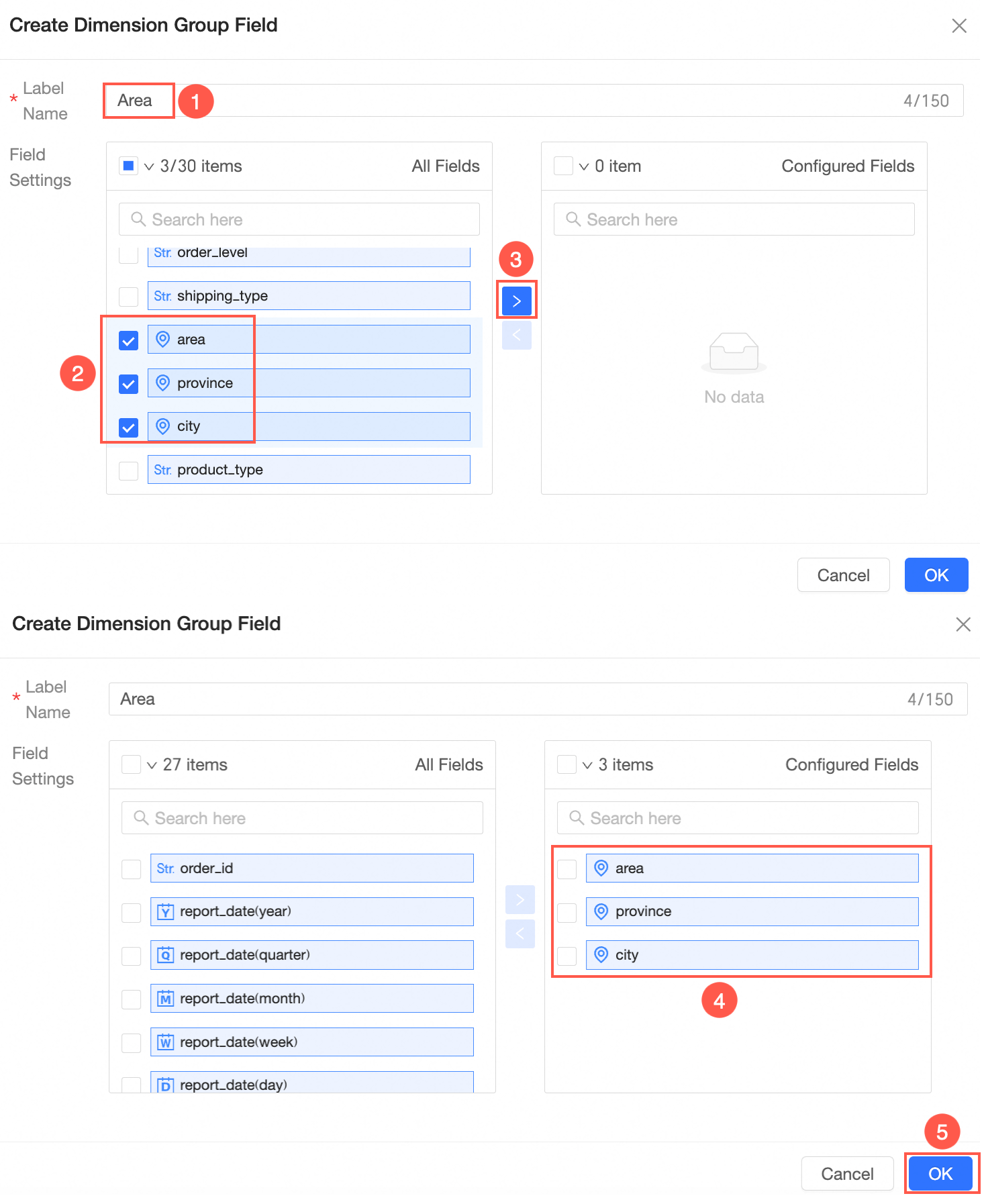
Open the Create Dimension Group page by following the steps shown in the figure.
-
Create the dimension group field as shown in the figure.
-
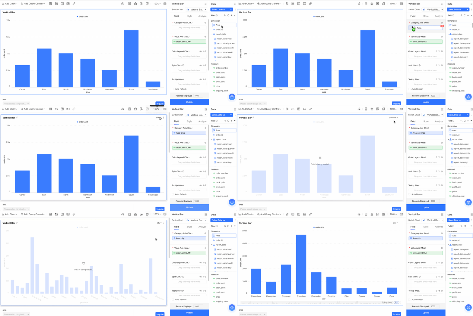
Drag the new dimension group to the dimension area and click Update.
You can now switch between fields in the dimension group to view the corresponding data.
Create a placeholder
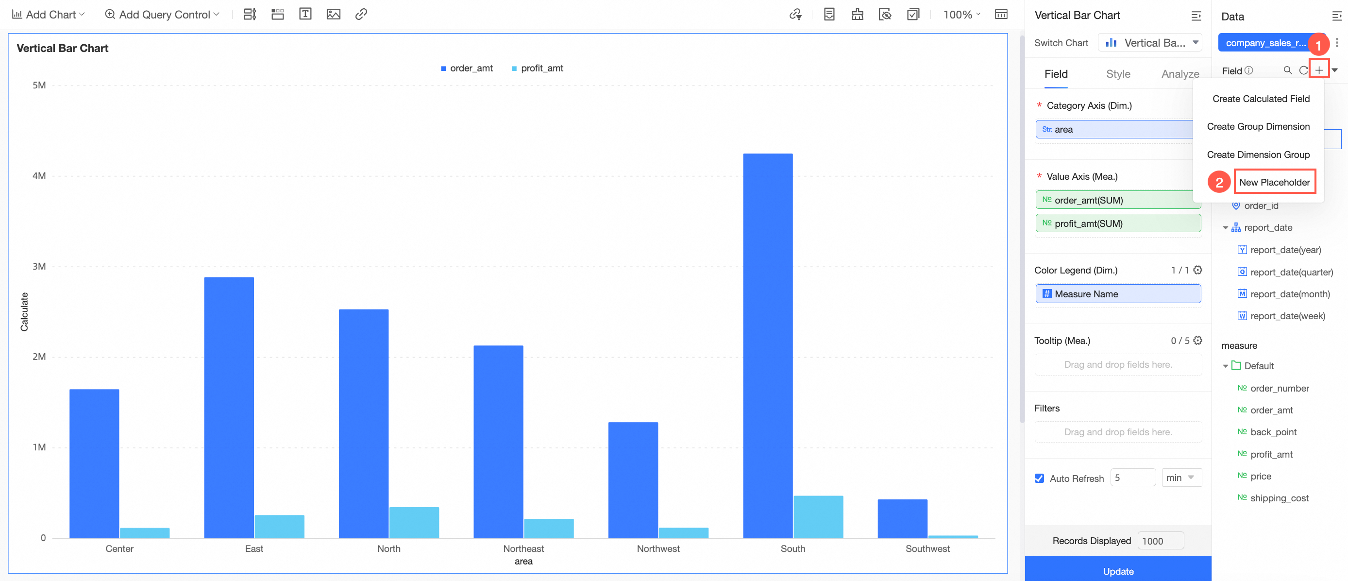
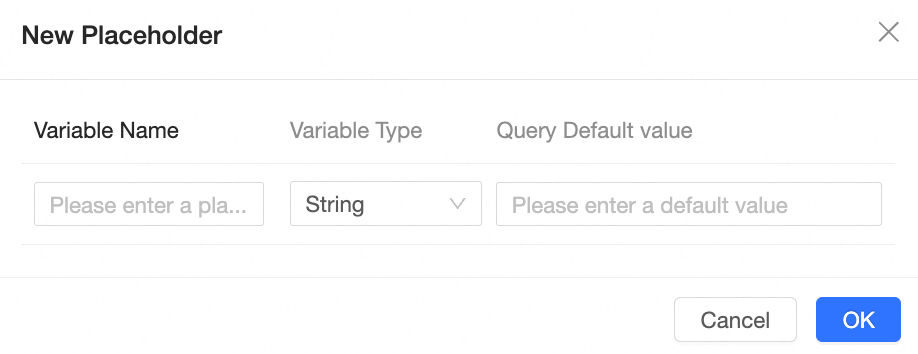
On the Create a placeholder page, enter the Variable Name, Variable Type, and Default Query Value.
-
After creating the placeholder, associate it with a query control.
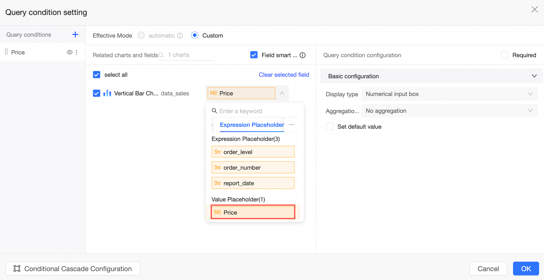
For detailed instructions and use cases, see Placeholder.
Calculate time difference
Calculate the elapsed time between two date fields. The result is a whole number, counting only complete units of the selected time interval.
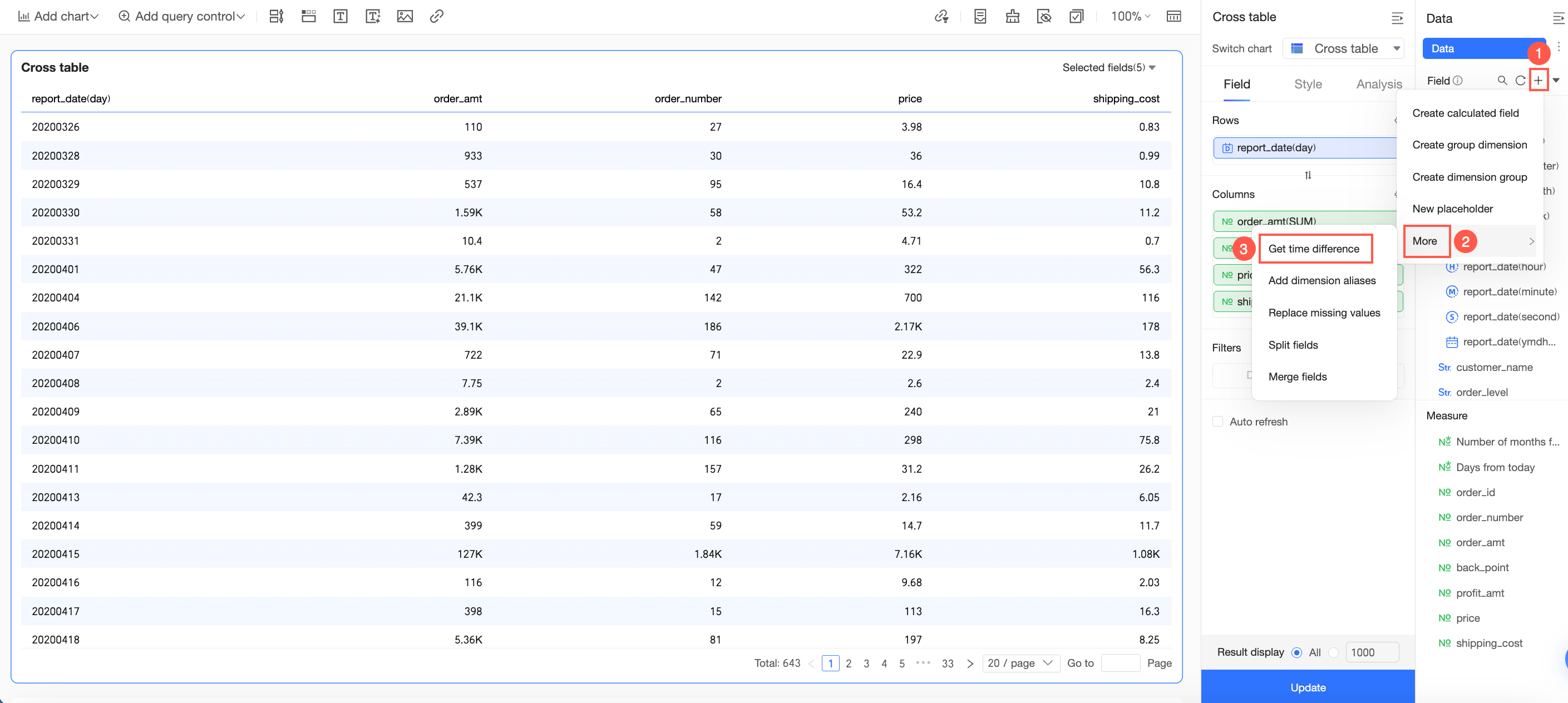
For detailed instructions, see Calculate time difference.
Add dimension value alias
Assign a display alias to an enumerated value in a text field, so the chart shows a more meaningful label instead of the raw value.
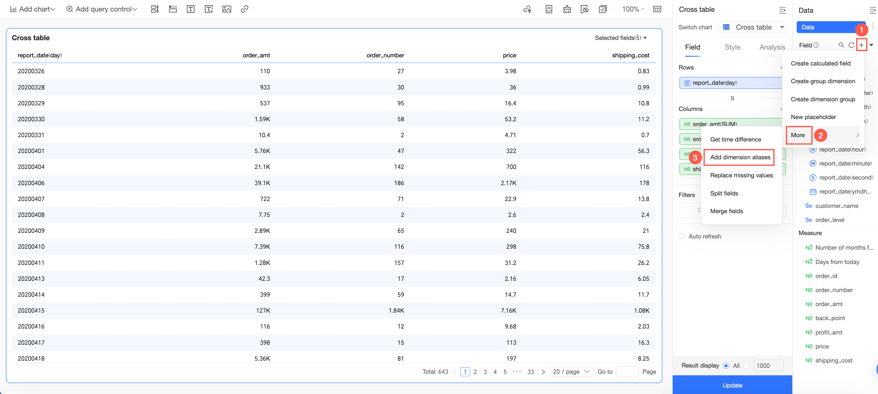
For detailed instructions, see Add an alias for a dimension value.
Missing value replacement
Replace null values and empty strings in a field with specified content. This modifies the underlying data values, not just how they are displayed.
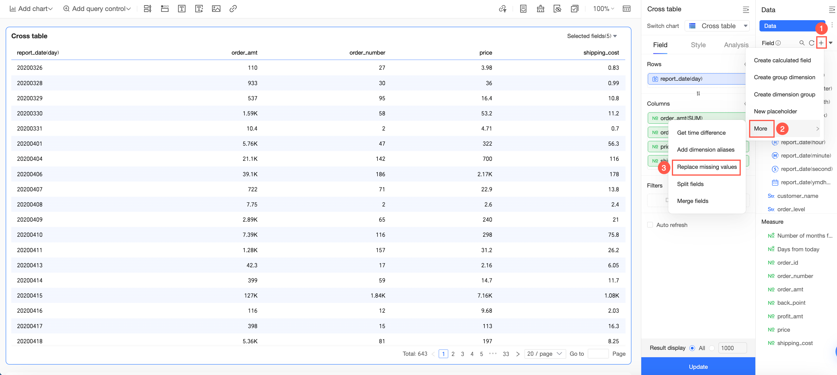
For detailed instructions, see Missing value replacement.
Split field
Split a text field into multiple fields using a delimiter character.
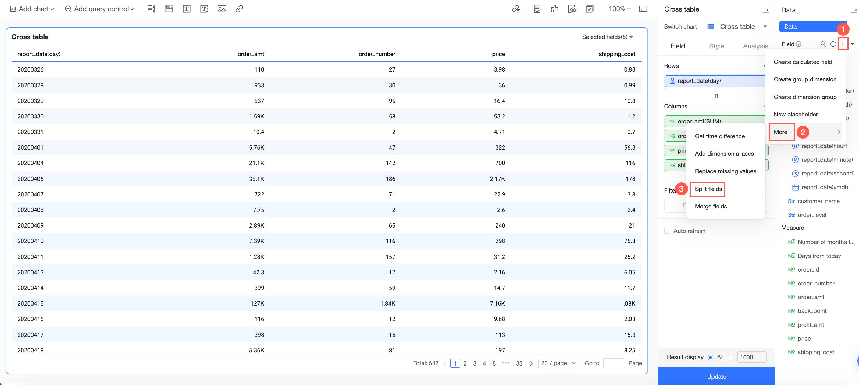
For detailed instructions, see Split field.
Merge fields
Combine multiple text fields into a single new field using a concatenation character.
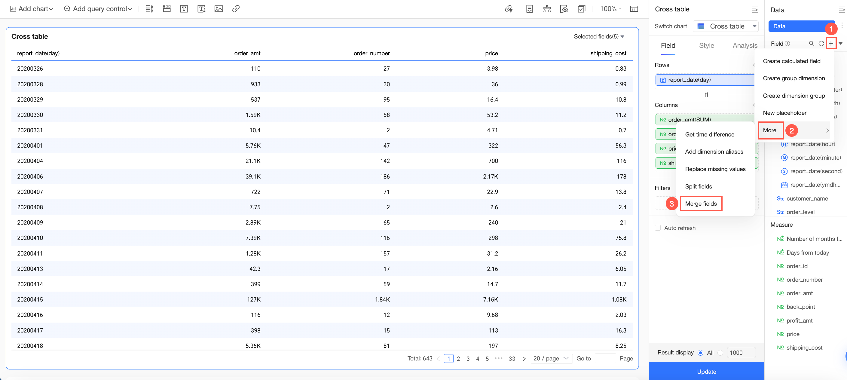
For detailed instructions, see Merge fields.
Change the dataset
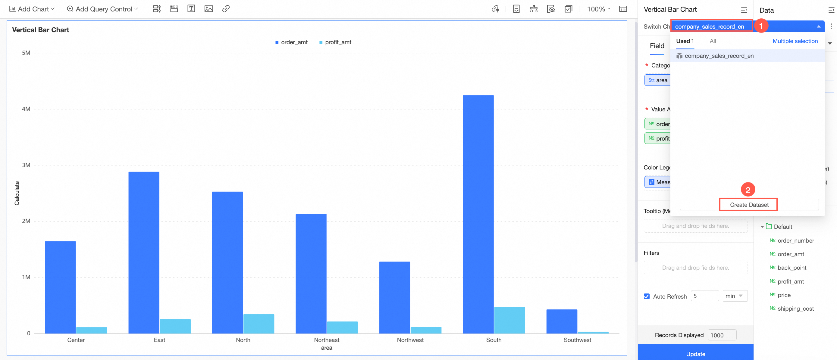
Open the dataset switcher
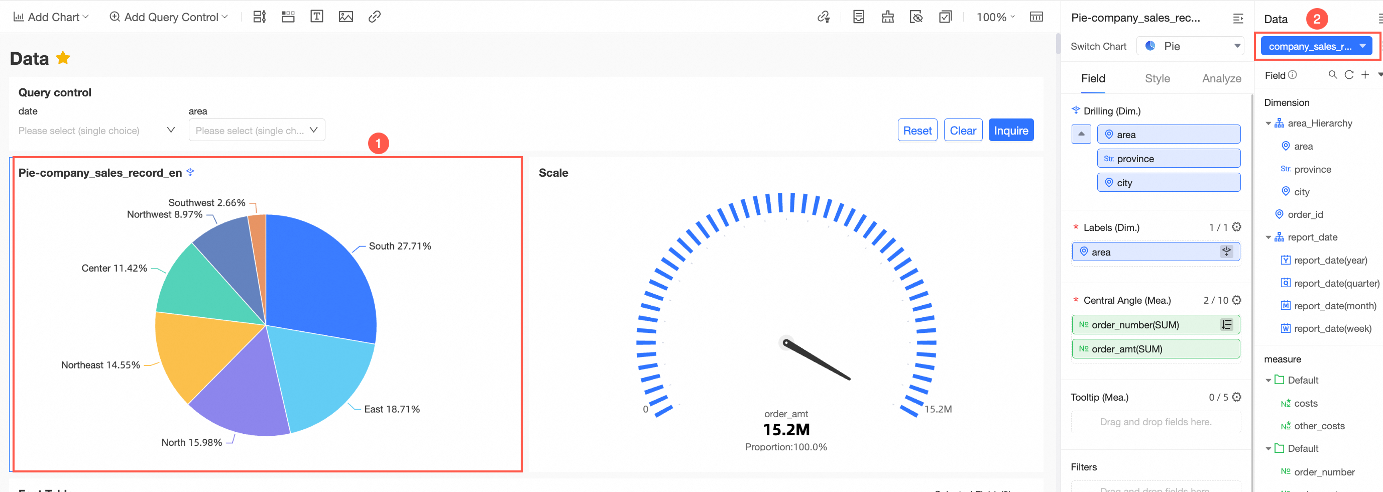
-
The switch box lets you toggle between the currently used dataset and all available datasets. Switching this way clears all field settings.
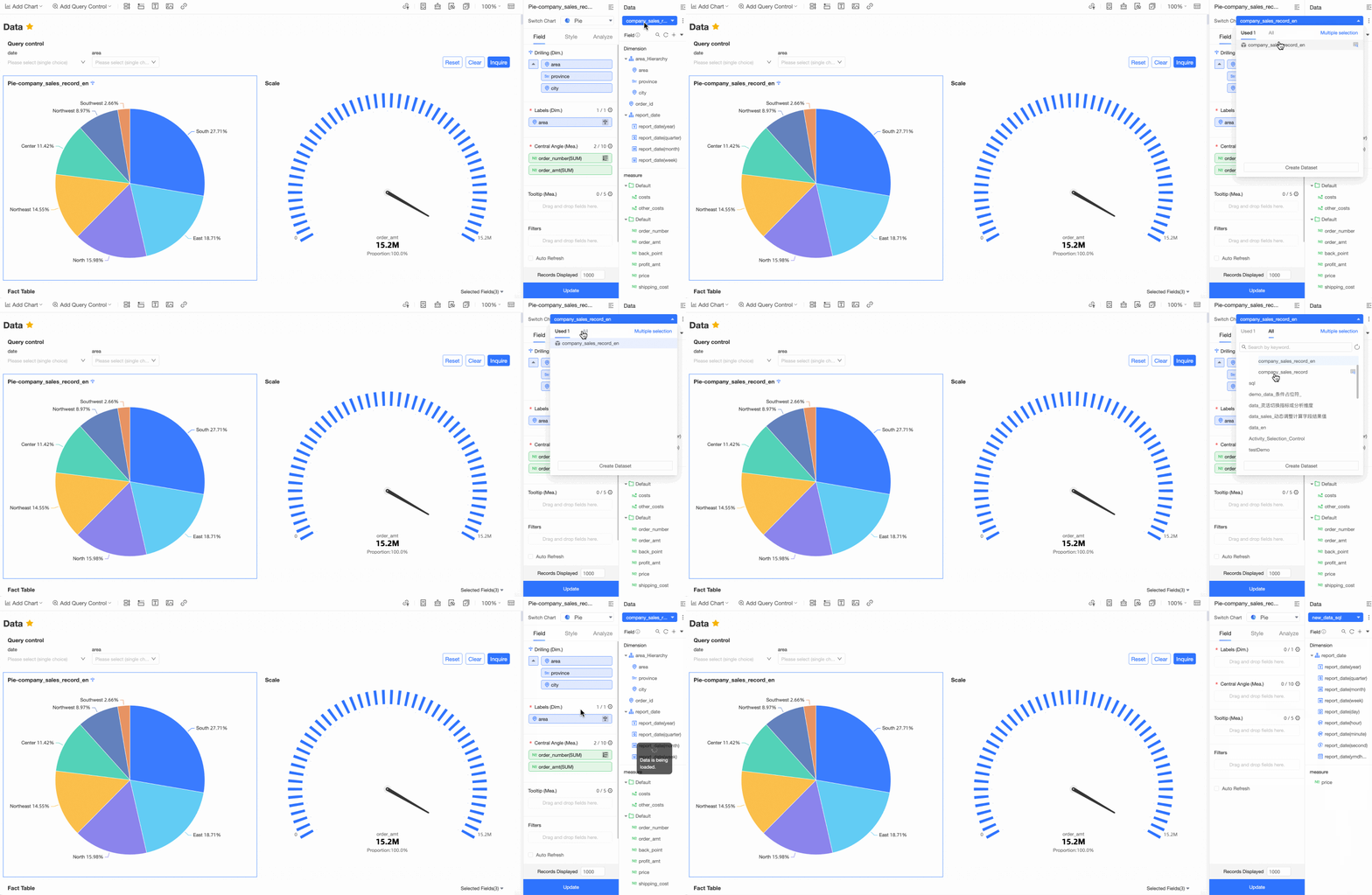
To replace the dataset and keep the existing field settings, click the
 icon to replace the current dataset.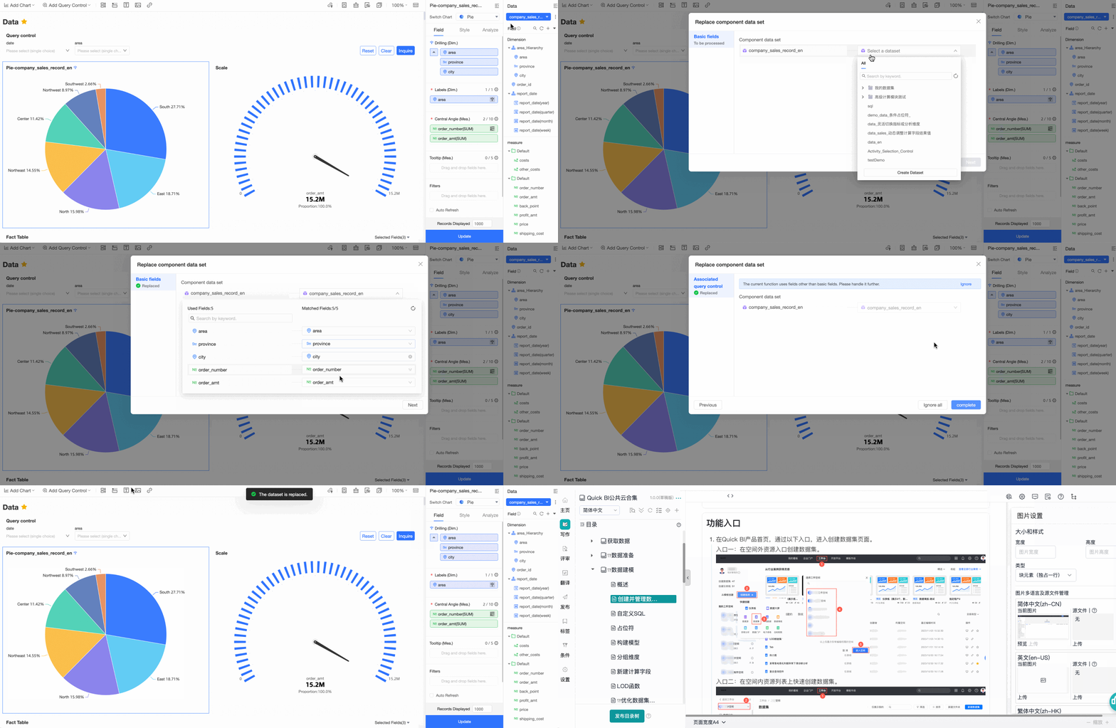
For detailed instructions, see Replace a dataset.
Create a dataset
Preview dataset data
-
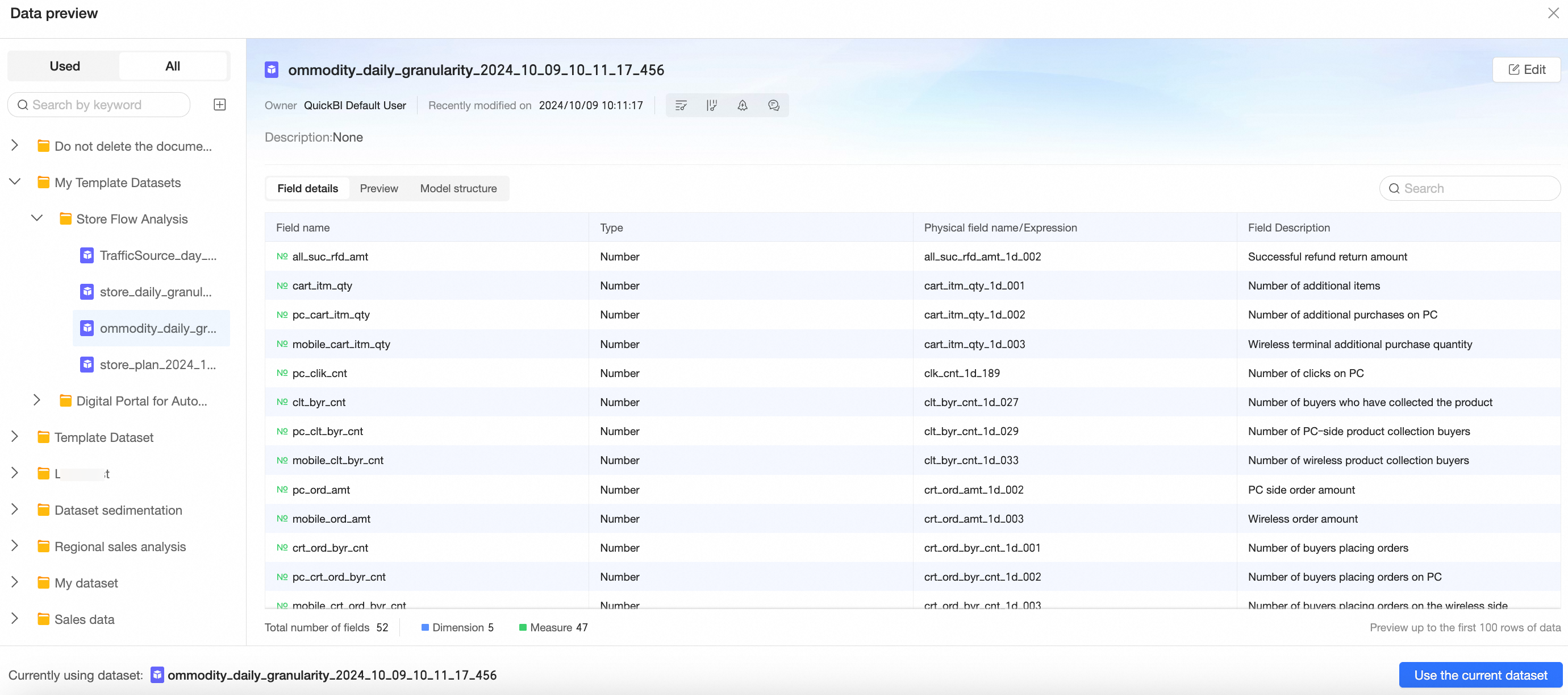
Open the data preview from either of these two entry points:
Entry point 1:
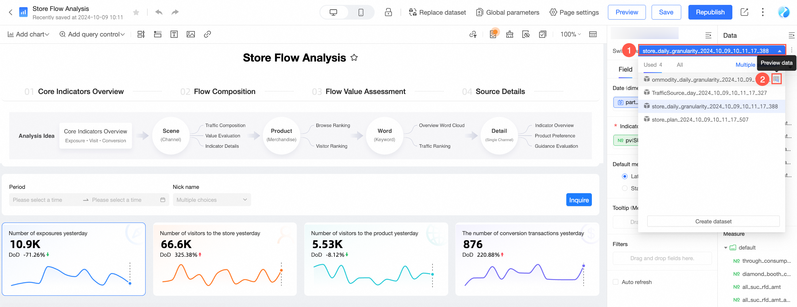
Entry point 2:
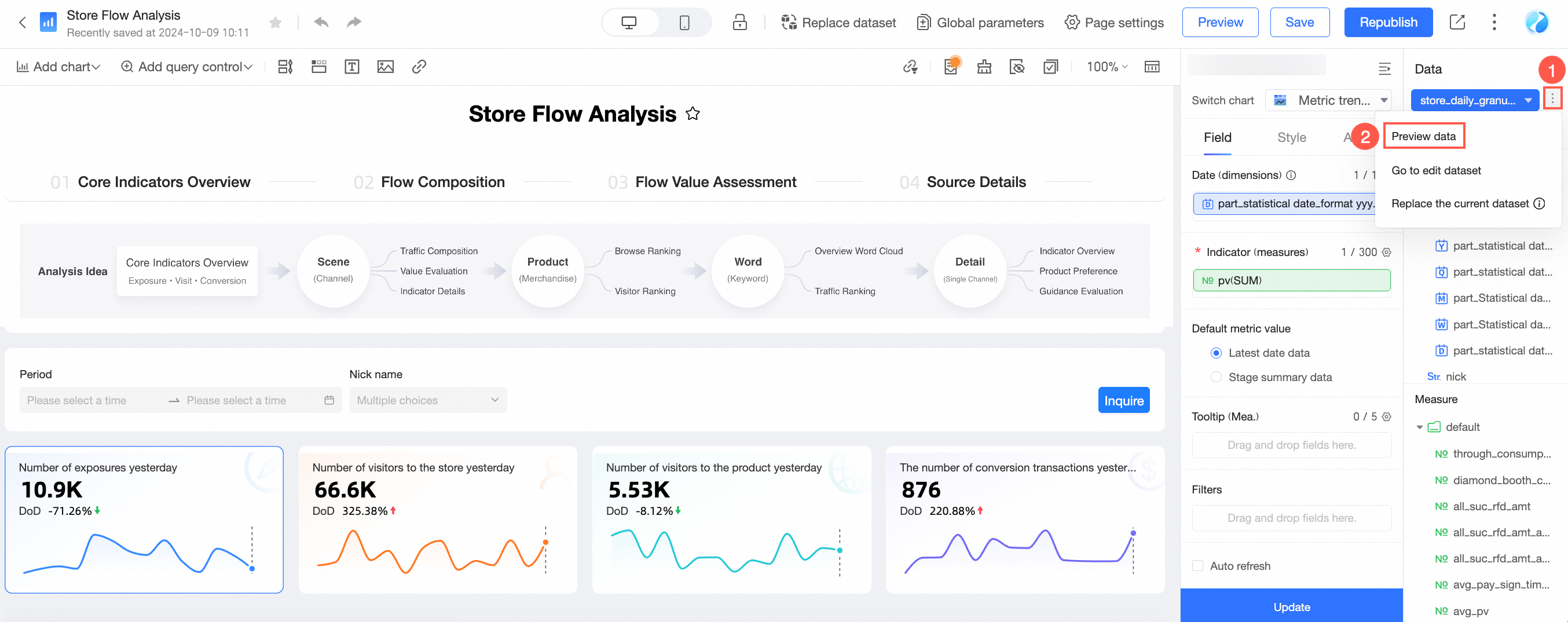
-
In the data preview pane, you can view field details, preview data, and the model structure for both the currently used dataset and all available datasets. For details, see Create a dataset.
-
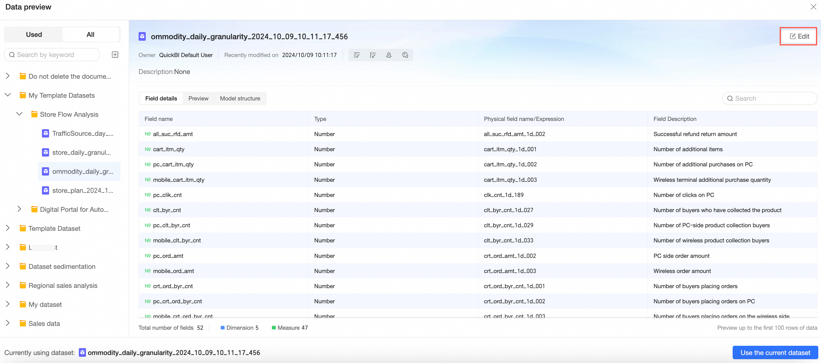
Click the Edit icon in the upper-right corner to go to the dataset edit page.
For details, see Create a dataset.
-
Click Use This Dataset in the lower-right corner to switch to the previewed dataset.
NoteThis clears previously used field settings. To switch datasets while keeping field settings, click the
icon and select Replace current dataset. For details, see Replace a dataset. -
Click the
 icon in the left panel to go to the create dataset page.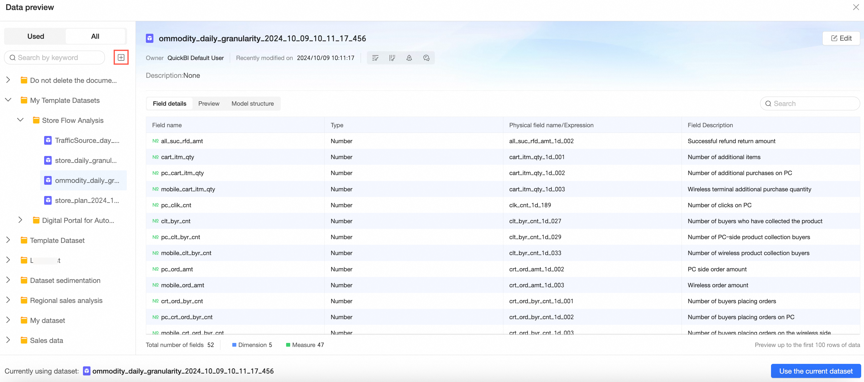
For details, see Create a dataset.
-
Edit a dataset
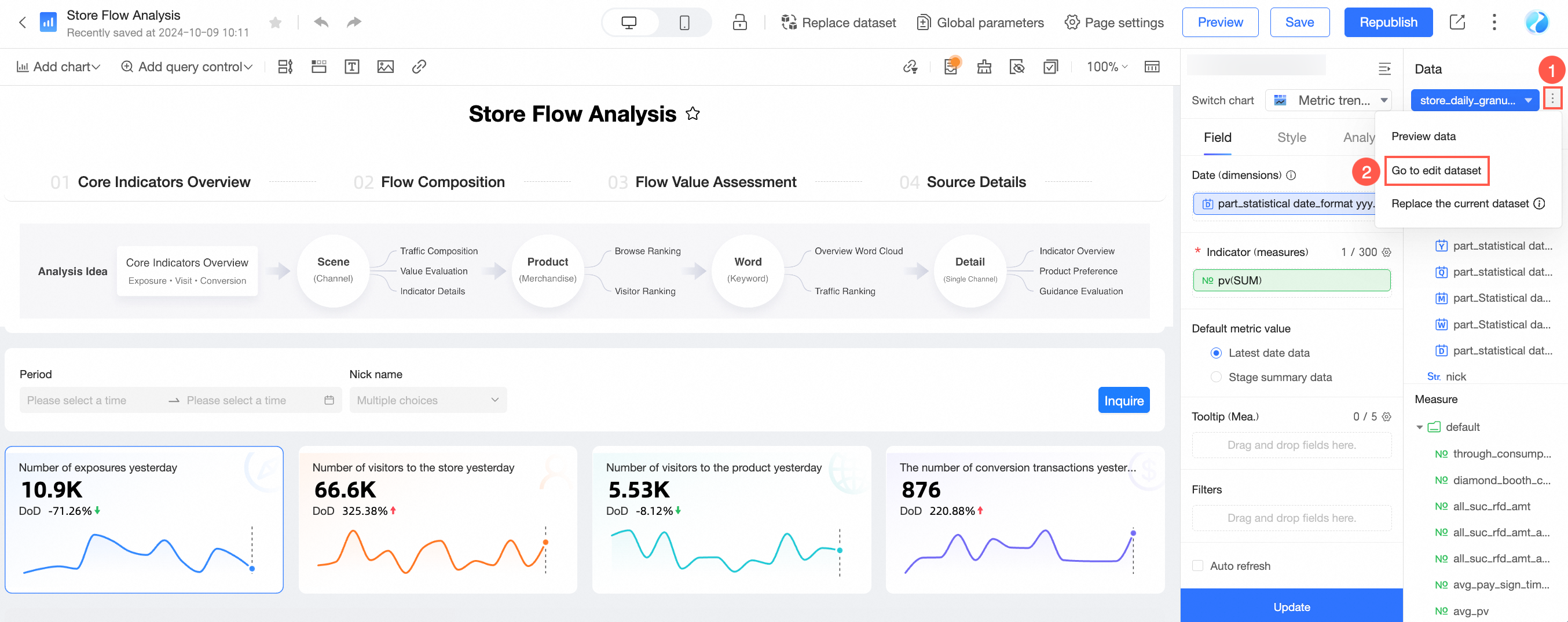
For example, to create a map chart, change the field type of a geographic dimension to Geographic Information.
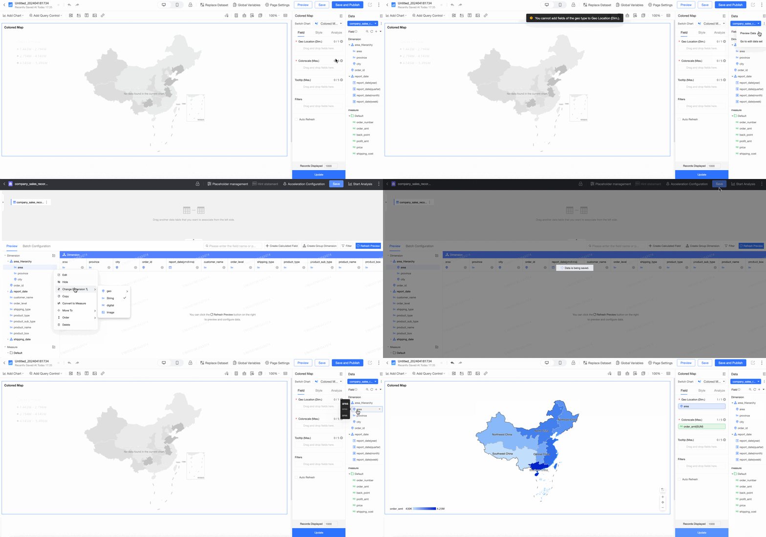
For details on editing datasets, see Create a dataset.