A custom image base map serves as the foundation for building heatmaps. You can configure a custom image base map and match it with a dataset.
Create and configure a custom image base map
-
As an organization administrator, follow the instructions in the following figure to open the custom image base map configuration page.

-
Click the
 icon Create and enter a custom image base map name.
-
Upload a custom image base map.
You can click Upload to upload the first image or drag the image to this section. After you upload the first image, you can click the
 icon in the upper-right corner to upload multiple images.
 -
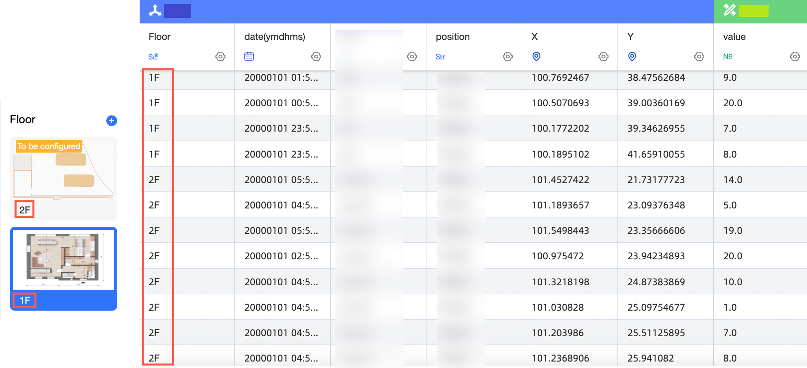
Click the name below the image to modify the floor name.
 Important
The floor name here must match the floor name in the dataset. Otherwise, charts that reference the image cannot be displayed.
For example, the floor 1F,2F of a custom image base map corresponds to the 1F,2F of the floor field in the dataset.
-
Configure image boundaries.
Select an image, select Coordinate Mode, and then enter the upper-left and lower-right latitude and longitude or X and Y coordinates in the Image Boundary Settings section.
-
Select Latitude and Longitude or Custom Coordinate System as the coordinate mode.
-
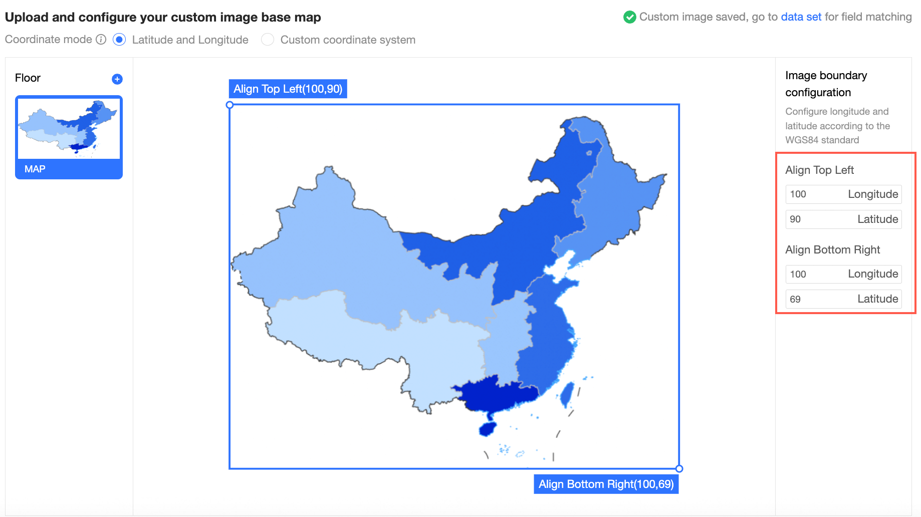
Longitude and Latitude: Configure the longitude and latitude based on the WGS84 standard. Valid longitude values: -180 to 180. Valid latitude values: -90 to 90.
-
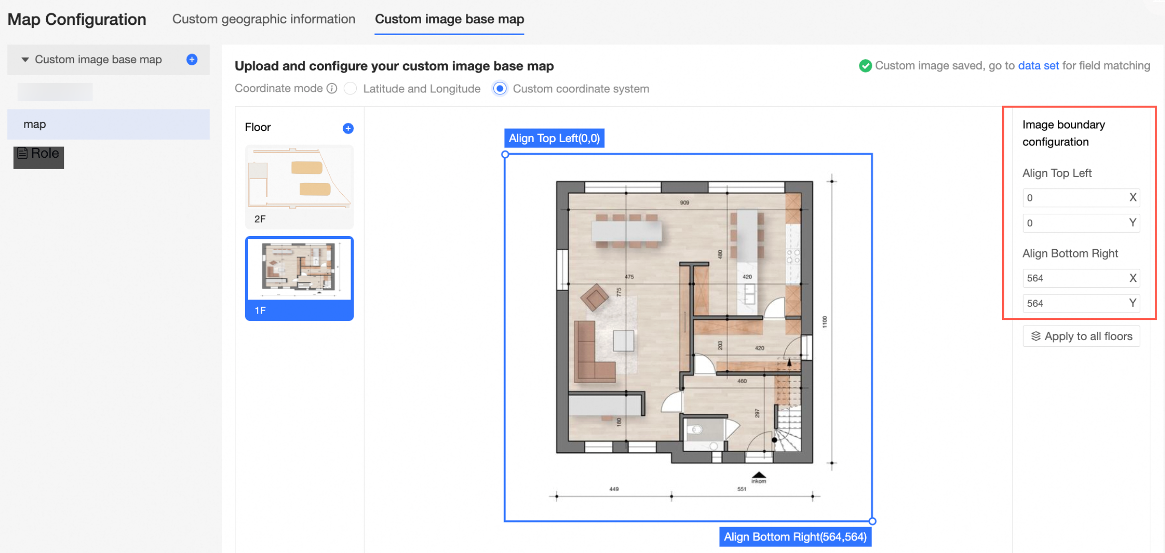
Custom Coordinate System: Configure the X and Y coordinates of the image.
-
-
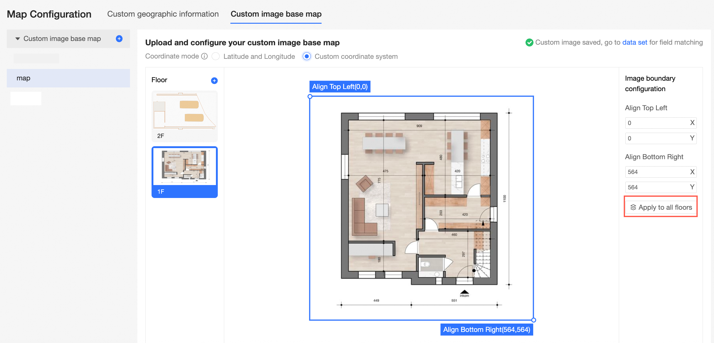
If multiple images exist, you can apply the boundary data to all floors.
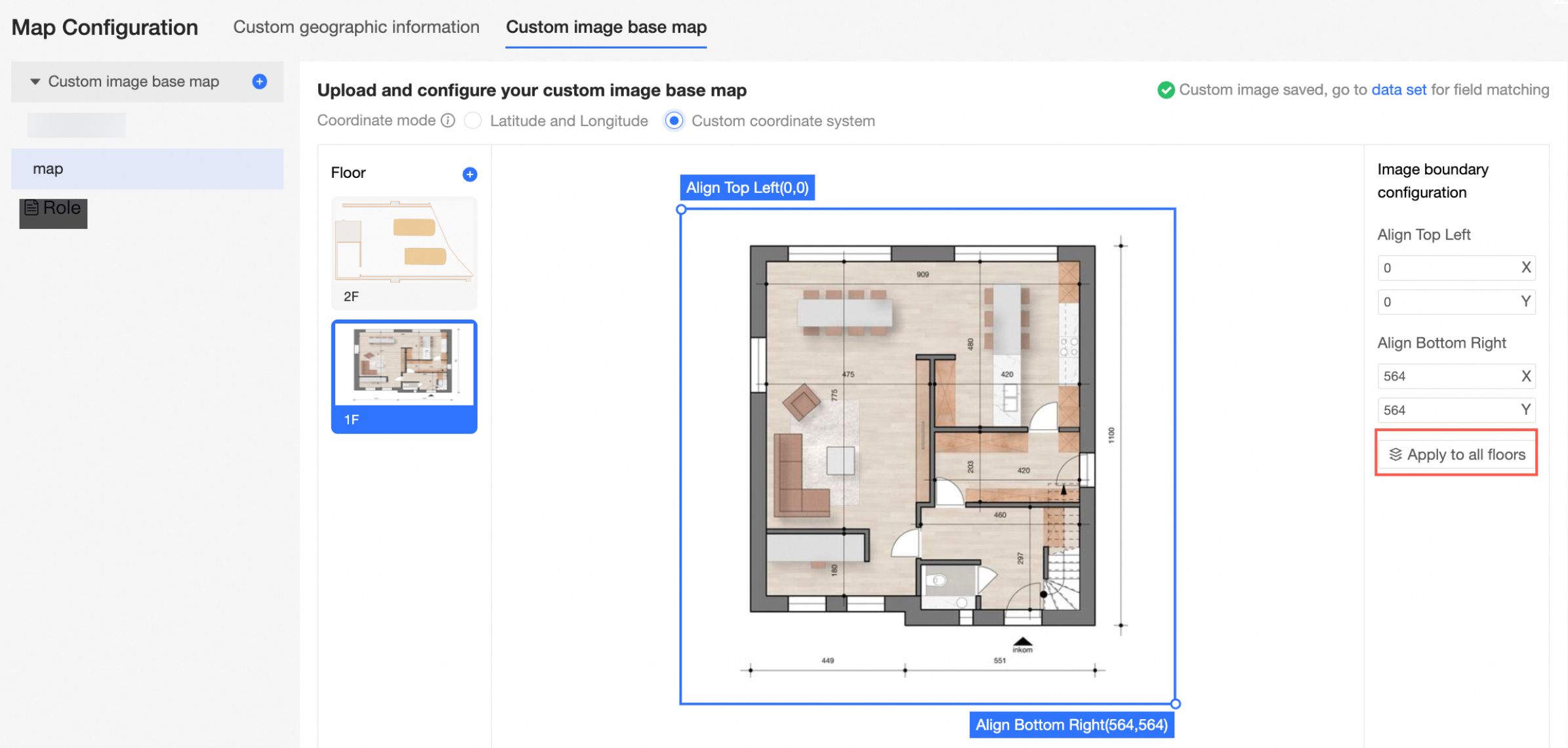
-
-
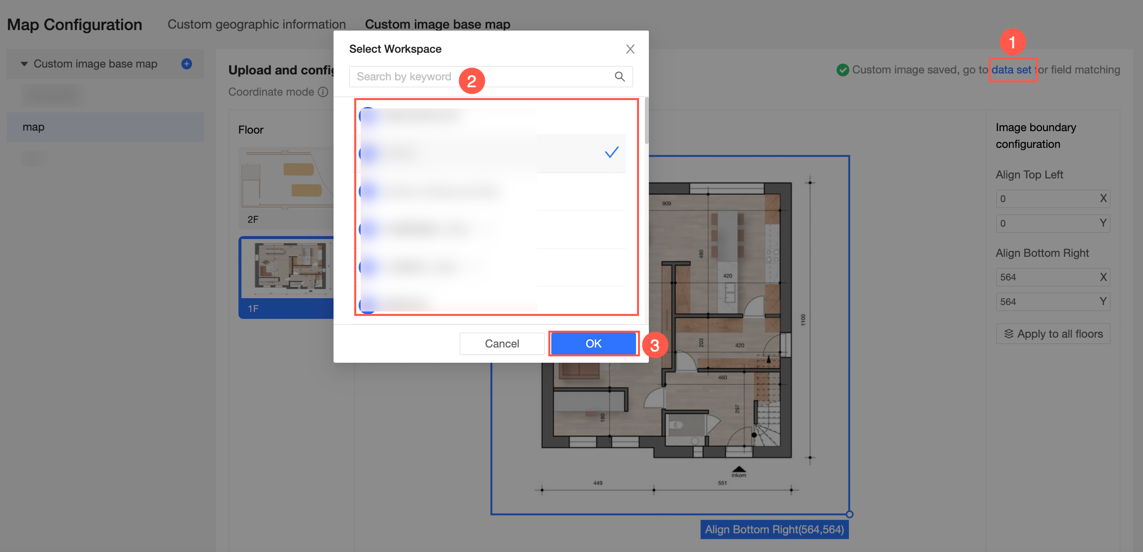
After the configuration is complete, go to the dataset to perform field matching.
Dataset field matching
-
As shown in the following figure, click Datasets-> Select Workspace-> Click OK to go to the dataset management page.
-
Click Create Dataset to go to the dataset editing page.
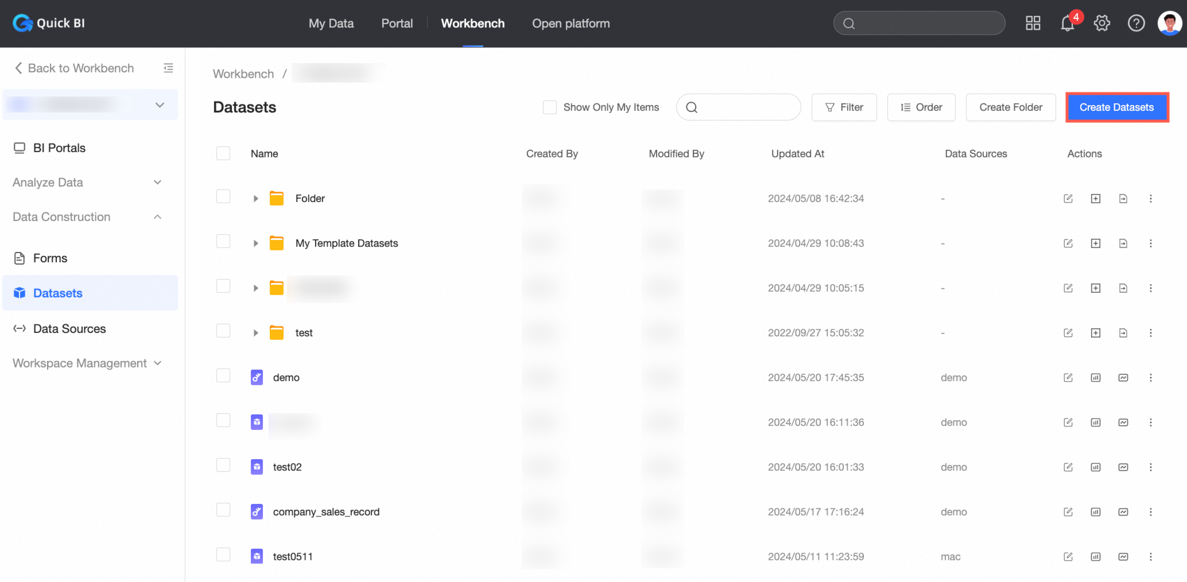
You can also click an existing dataset to go to the dataset editing page. For more information, see Create and manage datasets.
-
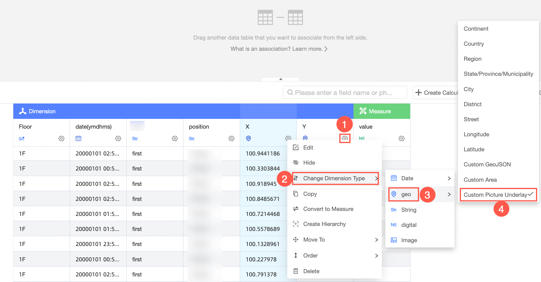
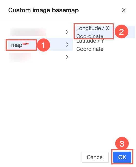
As shown in the following figure, change the longitude (or X-axis) and latitude (or Y-axis) data types of the heat point to the custom base map type and match them with the corresponding data types.
-
In the Custom image basemap, select an image and coordinates, and click OK to complete field matching.
-
After you edit the dataset, click Save in the upper-right corner of the page to save the dataset.
Support
View the result in the building heatmap.
See Building heatmap.