Quantum GIS (QGIS) is a user-friendly open-source desktop geographic information system (GIS) application. It supports multiple formats of raster images, vector images, and databases as data sources. Using QGIS, you can view, edit, manage, and analyze geospatial data, and create and export maps.
Add a connection to a GanosBase database
Run QGIS. In the Create a New PostGIS Connection dialog box, set connection parameters as required and click Test Connection.
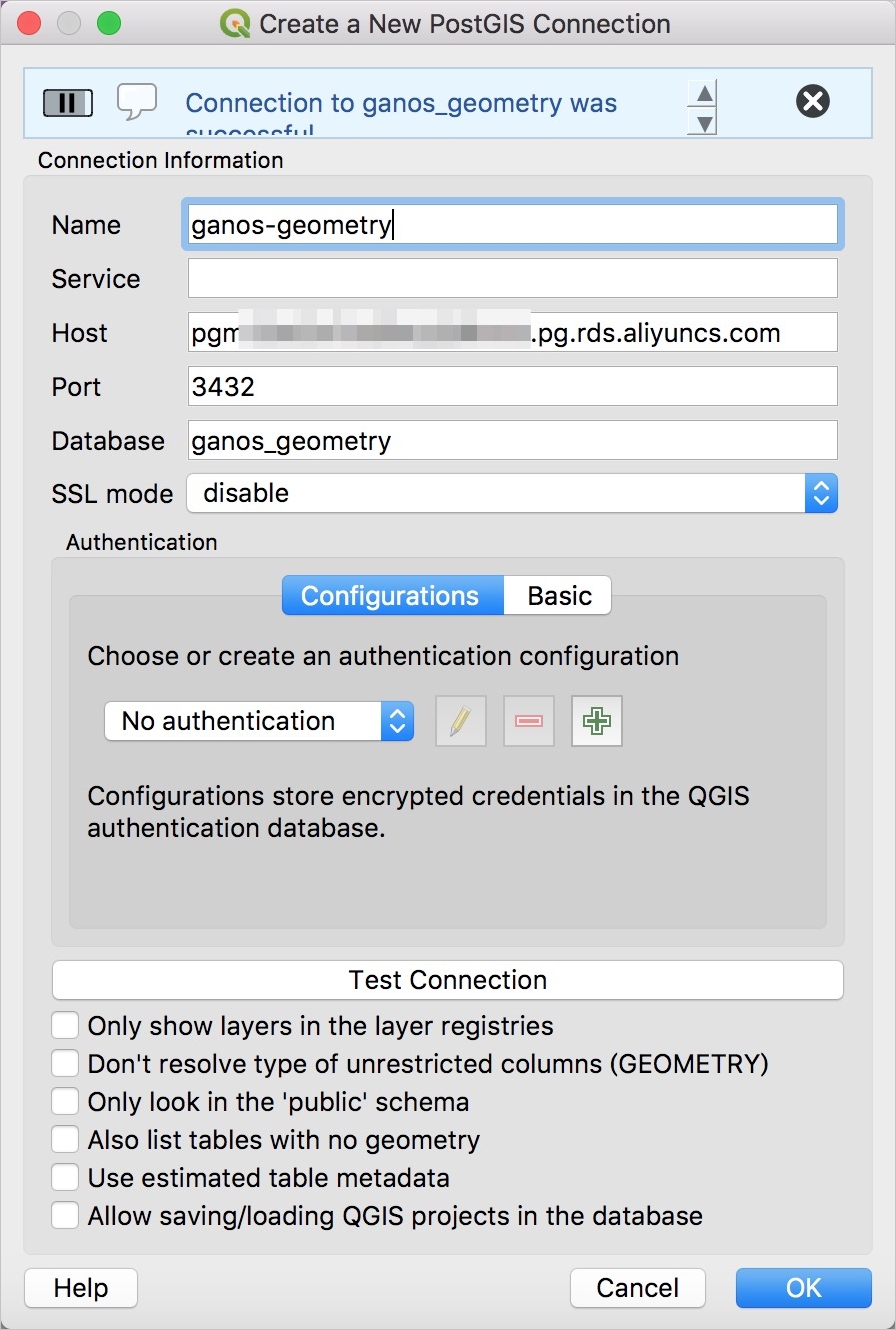
The following table describes the parameters.
Parameter
Description
Name
The custom name of the connection.
Host
The IP address of the database or the public network endpoint of the ApsaraDB for Relational Database Service (RDS) or PolarDB instance. You can obtain the endpoint from the Alibaba Cloud console.
Port
The port number of the database. You can obtain the port number from the Alibaba Cloud console.
Database
The name of the database to be connected.
SSL mode
The Secure Sockets Layer (SSL) encryption mode. Set this parameter to disable.
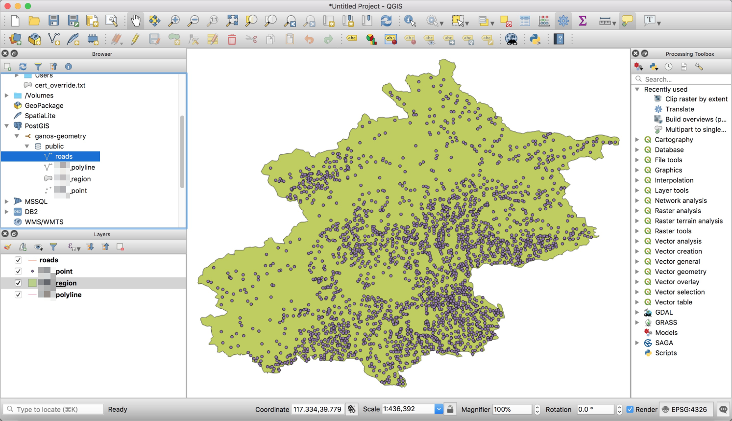
Select a connected GanosBase database. You can view the existing database and layers under the database. Double-click a layer to browse, view, and manage the geospatial data in the database.