This topic describesGanosBase GeomGrid extension.
GeomGrid
GeomGrid is a data type in theGanosBase GeomGrid extension that represents a geographic grid object.A geographic grid is a set of polygonal grid cells that reproduce the surface of the earth, used to represent geographic feature positions and integrate spatio-temporal data.Each grid cell is encoded with a one-to-one mapping.3D geographic grids incorporate height in addition to latitude and longitude for subdivision and encoding.
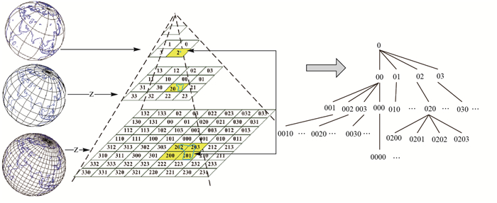
The following data types can be converted to GeomGrid:
text
bytea
geometry
meshgeom
sfmesh
vomesh
GeomGrid can be converted to the following data types:
text
bytea
geometry
box/box3d
meshgeom
vomesh
H3Grid
H3Grid is GanosBase GeomGridextension. It is a hexagonal hierarchical geospatial indexing system based on Uber H3 indexing.
The following data types can be converted to H3Grid:
text
bytea
integer
Longitude and latitude
H3Grid can be converted to the following data types:
text
bytea
geometry